These learning modules are intended to assist you to prepare for labs or to study for lab exams. They are not required but may be of substantial help. We recommend that you look them over before lab and after lab read or work through the parts that reinforce lab materials. Let us know if any of the links below are broken or need attention.
Google Earth (GE) kmz files to go along with labs. Lab KMZ These images correspond to many landscapes in the lab exercises, especially labs 7 through 12. They are not required but will enhance your lab experience by allowing you to explore the surrounding landscapes of the landforms studied in lab. (Don't confuse these with the lab project kmz files which are elsewhere.) To use these lab kmz files, click on the link above, save the zip file to a local storage site on your computer or storage device, double click on the copy, and drag the six kmz files to uncompact them. Once unpacked, double click on a kmz file to load it into GE (you must have GE install on your computer for them to run). Save My Places in GE when done to keep them in your GE system. (See GE instructions in Lab #1 for GE operating instructions.)
Click on the item below to run the
tutorials or download files.
Metric Units: One way to learn the prefixes in the Systeme International metric units is to remember the adage: king henry doesn't [Usually] drink chocolate milk. The letters in this mnemonic represent the prefixes for modifying units from 1000 x to 1/1000 x; that is: kilo, hecto, deca, [unit], deci, centi, and milli. For example: km = 1000 m.
Exercise #
1
Cartographic Interpretations
Lab1.kmz (save file to desktop and open into or
drag onto Google Earth) - Pages 11 and 12 of the first lab refer to a Lab1.kmz
file. Use this file ("Lab1 Maps.kmz") to answer the questions about the
Greenwich Royal Observatory, etc. The same file should be on
Blackboard under 'Content'.
Greenwich Latitude advanced discussion (read text below).
Practice reading contour maps (Sierra Nevada topo maps).
3 Soils
Sand Sieving USDA on YouTube http://www.youtube.com/watch?v=-4qqqwzDWvI
Dry sieving video - http://core.ecu.edu/geology/rigsbyc/rigsby/Sedimentology/drysieve.rm
Pete's Lab http://www.youtube.com/watch?v=QFqpzkVyRRU
Wet Sieving video: http://core.ecu.edu/geology/rigsbyc/rigsby/Sedimentology/wetfinal.rm
Hydrometer Analysis for fine textures USDA on YouTube http://www.youtube.com/watch?
...
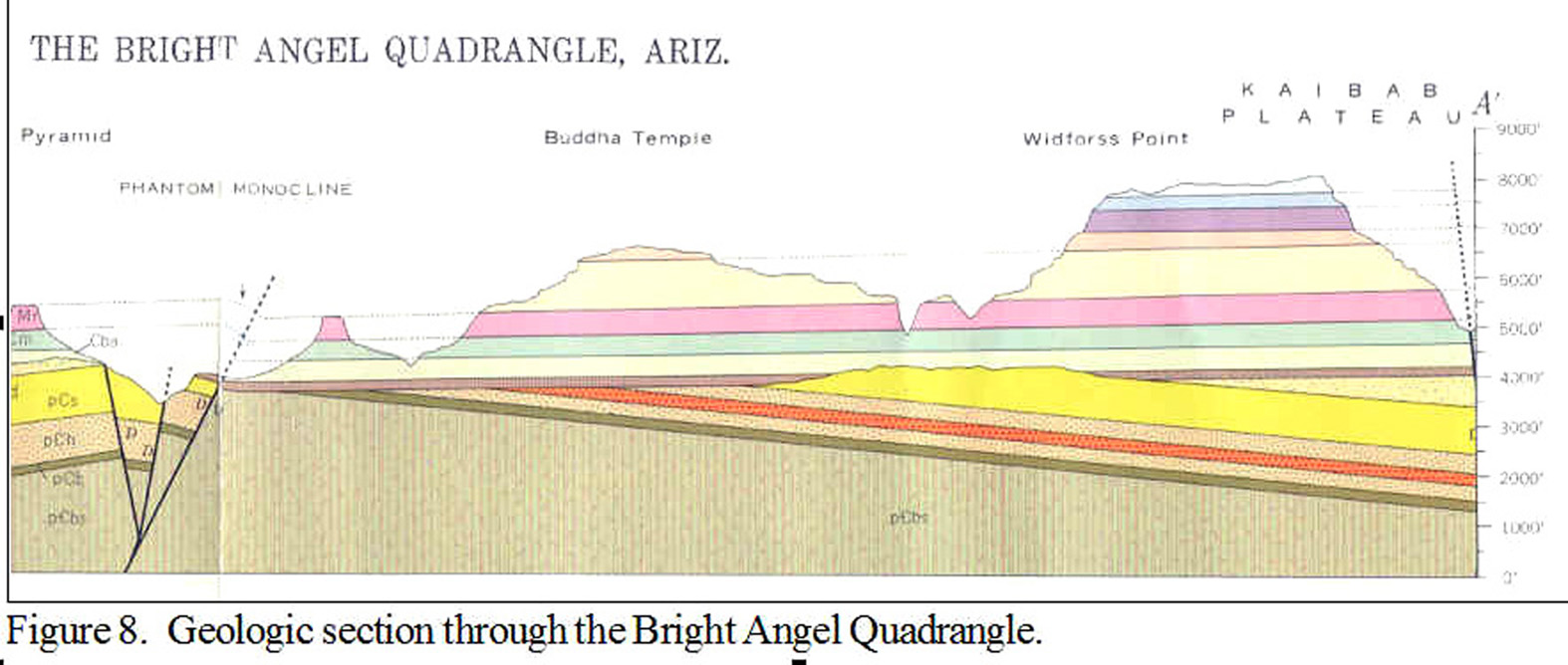
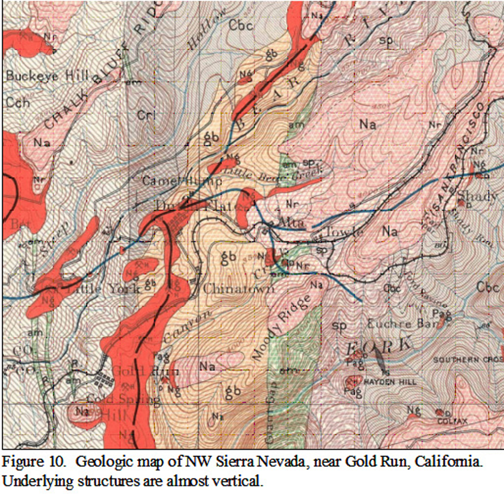
7 Structures - Maps (color versions of Figures 7-11 & 7-12)
Grand Canyon Geology Section (Fig.7-11)
Sierra Nevada Geology Map (Fig.7-12)
Advanced Greenwich Longitude
Concept: Longitude at the Greenwich observatory measured on Google Earth or from a
GPS receiver may be off from 0 degrees by about 100 m. This is because Google Earth and GPS
units may use a mathematical reference system for the Earth that adjusts
surfaces to sea level for a spheroidal Earth. This system, World Geodetic System
84 (WGS 84), is geocentric (based on the center of the
Earth) so coordinates will not agree exactly with maps that are based on a local
or regional spheroid that best fits that region. If using WGS84 youd need to
transform coordinates to the regional datum to plot GPS positions precisely on a
map. Many GPS receivers have the option of giving positions in a regional datum
to avoid this problem.
Source of information: Royal Museums Greenwich.
http://www.rmg.co.uk/explore/astronomy-and-time/astronomy-facts/history/the-longitude-of-greenwich