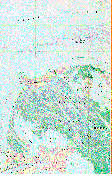
Part of the topographic-bathymetric map "Kedges Straits, Maryland," quadrangle, 1972, bathymetry added 1987, by the USGS and the National Ocean Survey, 1:24,000, Lambert conformal conic projection, 22 x 28 inches.
Back to USGS Maps