Rocky Branch
Watershed
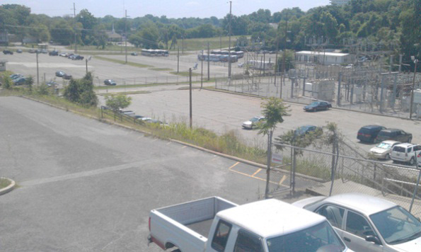
Lower RBC: In the fall of 2011, a proposal
for the City of Columbia to sell the old baseball stadium and surrounding lands
generated a large public outcry. This galvanized the community to form the Rocky
Branch Watershed Alliance (RBWA) to study flooding and water quality in the
basin and to advocate for wise management by City and County governments. The
Alliance was successful in postponing sale of the land for a few months until a
new hydrologic and hydraulic study could be conducted by AMEC Environment and
Infrastructure, Inc., a private engineering consulting firm. The AMEC report
summarized the available hydrologic and hydraulic (H&H) information
available, although it did not develop new hydrologic data or models. Their
hydraulic analysis of the 0.01% probability (100-yr recurrence interval) flood
identified the abandoned railroad culvert between Bluff Road and Olympia Park as
creating backwater upstream as far as Assembly Street. Removal of this culvert
would lower floods upstream, although it would pass flood waves downstream
causing flooding in Olympia Park due to the constriction by the Olympia Avenue
Bridge, which would need to be enlarged. They recommended further study for
removing the culvert and enlarging the culvert under Olympia Avenue.
The City of Columbia recently signed a
contract approving sale of the old baseball stadium to developers who plan
to fill much of the 100-year floodway with a parking lot. This is permissible by
FEMA regulations because the hydraulic studies by AMEC found that the parking
lot will not raise flood stage under existing conditions; that is, under the
presently impaired conditions with the Bluff Road railroad embankment impeding
flows. AMEC representatives informed my at a City hearing in June that hydraulic
model runs indicate that the parking lot of the development will increase
100-year flood stages as much as ~0.20 ft above the levels they would reach if
the Bluff road culvert is removed. The increased flood levels caused by
infilling of the floodway will not reach much above Assembly, so these changes
in hydraulics have no bearing on flooding in Five Points area. According to the
contract, the developers are purportedly committed to instigating flood
reduction measures, presumably removal of the Bluff Road RR culvert and
enlargement of the Olympia Avenue culvert. The City of Columbia has also
purportedly devoted ~$500,000 for other improvements to reduce flooding in
RBC.
While piecemeal hydraulic improvements such as the
Bluff Road culvert removal are needed, the
long-term reduction of flooding in
RBC will require reductions in storm-water generation
(hydrology) in addition
to hydraulic changes. This is particularly true in the Five Points
area,
which has a long history of flooding due, in large part, to increases
in stormwater runoff as urban infilling resulted in increasing areas of
impervious surfaces upstream. Rain water cannot seep through impervious
surfaces, so it runs off rapidly to ditches, storm sewers, and channels.
Considerable progress has been made in urban hydrology in understanding the
importance of impervious surfaces to flooding and water quality. Watershed
studies have shown, not only that impervious surfaces cause increased flooding,
but also that when the percentage of impervious surfaces exceeds 10%,
substantial reductions begin to occur to water quality and aquatic habitats. A
2008 masters thesis in the MEERM program of USC by John Wooten measured the
percent
impervious surface area for RBW using 2007 Pictometry imagery (high
resolution aerial photographs). Wooten found that almost 50% of the surface area
of the basin was covered by impervious materials including roads, buildings, and
parking lots.
Mitigation of urban effects on hydrology is possible
through low-impact development (LID) or green infrastructure that encourage
infiltration of rainwater. A green infrastructure pilot study, including
permeable asphalt, infiltration chambers, and rain gardens, is currently being
applied in the Shandon neighborhood of the Gills Creek watershed to the east of
RBW. These methods should be encouraged in the RBW methods to reduce
floodwaters. Moreover, a combination of incentives and regulations is needed to
encourage LID and discourage rampant paving of surfaces.
Several opportunities exist for urban improvements that
depend upon wise development and restoration of RBC. RBC has become a serious
liability in terms of flood risk and public health. Urban streams can be a
community asset. River restoration would allow the potential assets of RBC to be
realized. A greenway from the Congaree River to Martin Luther King Park has long
been seen as a possible means of linking Five Points to many miles of existing
pedestrian and bicycle paths of the Three Rivers Greenway in Columbia and West
Columbia:
http://www.sciway.net/sc-photos/richland-county/three-rivers-greenway.html
http://www.scgreatoutdoors.com/park-westcolumbiariverwalk.html
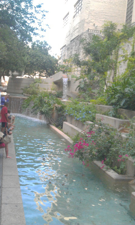 Figure 2. San Antonio River
Walk. People come from all around the world to sip fine wines next to an urban
stream.
Figure 2. San Antonio River
Walk. People come from all around the world to sip fine wines next to an urban
stream.
Last Modified: 8/17/2012 Allan
James (AJames@sc.edu)