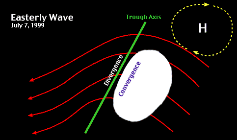
| Tropical cyclones often develop along easterly waves. These waves, or oscillations, in the trade winds move from east to west across the tropics. Satellite imagery provides the best view of an easterly wave. As low-level winds enter the trough of the wave, they converge, causing convection. Overlay the satellite imagery on the streamlines below to see the relationship between convection and cloud formation. Tropical meteorologists watch for areas with such convection in order to determine likely sites for tropical cyclone formation.
 Satellite Satellite  Overlay Overlay  Diagram Diagram
|


